
Unverified
Sat imageries (before/after) of the destruction in Tabontabon, Leyte
18:15 Nov 16 2013 Tabontabon, Philippines
Description
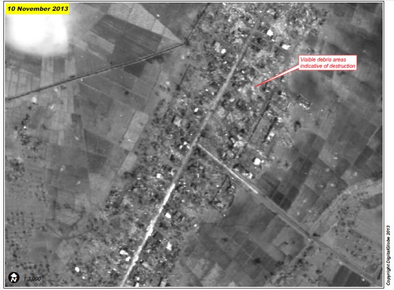
A portion of northern Tabontabon town almost completely eradicated by Typhoon Haiyan. See Figure 1 (next page) for pre-disaster comparison.A northern portion of the town of Tabontabon with multiple structures and tree cover visible intact in pre-crisis image (top) collected prior to Typhoon Haiyan. As of 10 November 2013 (bottom) most structures are gone with proximate debris indicative of complete destruction, and most tree cover likewise destroyed.
News Source Link
https://philippines.humanitarianresponse.info/sites/philippines.humanitarianresponse.info/files/UNOSAT_TC20131108PHL_Tabontabon_A4_Report_v1.pdfhttps://philippines.humanitarianresponse.info/typhoon-haiyan-yolanda-maps-and-visuals
| Credibility: |  |
 |
0 |
Additional Reports
1 video of floods and destructions at Dagami, Leyte
22:49 Nov 17, 2013
Dagami, Philippines, 6.71 Kms
Interactive map on damages - Estern Leyte - UNOSAT
14:53 Nov 12, 2013
Tacloban, Tanauan, Tolosan, Palo, Dulag, Santa Fe, Jaro, Alangalang, Eastern Late, Philippines, 8.71 Kms
8 photos and 1 video of Wind destruction at Tanauan
16:56 Nov 12, 2013
Tanauan, Leyte, Philippines, 9.8 Kms
Leave a Comment